|
|
Post by aura on Jun 25, 2012 22:02:07 GMT -5
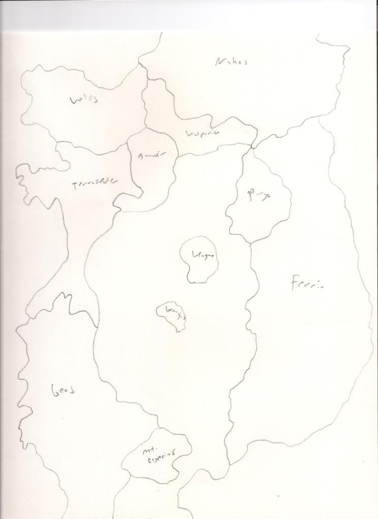
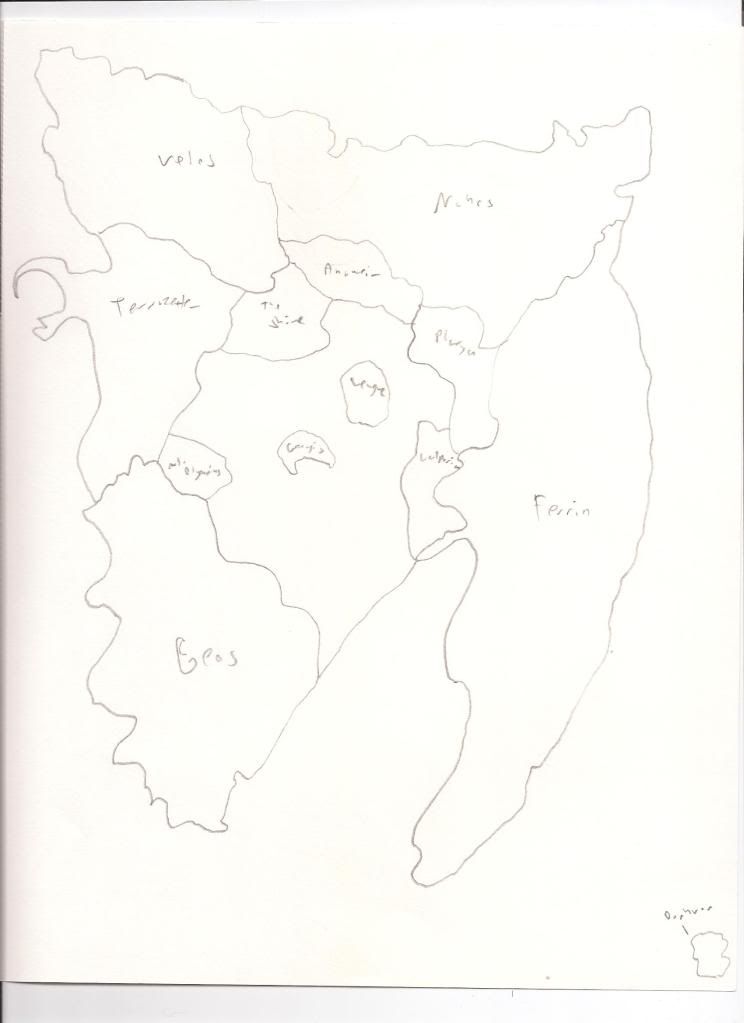
Ok I've drawn up a couple maps so far. I've used the basic information and just sketched up a couple things real quick.  Here is the first one. This map is an open continent. I have made it so certain section of the continent go off the map, thta way we can easily add more. We have Ferrin in the East. To the North Velos, and Naho, with Vulparia and Anweir located somewhat between them. Terraseuter on the West, with Geos on the SouthWest. The Leaugue is in the middle with Genagis slightly below that. Any area between country with no names in it are open areas for people to make new countries in later.  Here is number two. This one is a closed continent. Any new nations will either need to be made in the open areas or made as islands. Everything is mostly the same. With some changes to Vulparia, Plarya, and Mt. Olympus. I know my handwritting is terrible, but if you could give me some feedback that would be great. Tell me what you like, what you don't like, where you want your nations, if some nations need to be bigger/smaller, etc. |
|
|
|
Post by outerlimits on Jun 25, 2012 23:54:03 GMT -5
I like the first map more. Gives me the idea of the inbetween areas is mostly a wasteland, possibly from the war that devastated Genagis.
|
|
|
|
Post by aura on Jun 26, 2012 20:12:19 GMT -5
Cool. Well I already have to move Plarya to go in accordance with my new country, Gilfell. It will just be more in the southern section near Geos Grande and Ferrin.
|
|
|
|
Post by Inkshade on Jun 26, 2012 20:18:37 GMT -5
I like the shape of the first one. But Genagis should be smaller.
|
|